Tocht  Le Castellet - Vallon du canet 27.02.24 - Photo
 michelpaulin
michelpaulin

Gebruiker

© OpenStreetMap contributors
Lengte
Lengte
14,9 km
Max. hoogte
Max. hoogte
435 m
Positief hoogteverschil
352 m
Km-Effort
Km-Effort  
19,6 km
Min. hoogte
Min. hoogte
185 m
Negatief hoogteverschil
353 m
Boucle
Boucle
Ja
Datum van aanmaak :
2024-02-27 08:24:45.0
Laatste wijziging :
2024-02-27 15:09:16.578

(0 Bericht)


Scan deze QR-code om de tocht te openen in de SityTrail-applicatie

Gratisgps-wandelapplicatie

Logo SityTrail SityTrail

IGN / Geografische instituten

SityTrail uit de App Store downloaden SityTrail uit Google Play downloaden

Logo SityTrail SityTrail World

De wereld gaat voor u open

SityTrail uit de App Store downloaden SityTrail uit Google Play downloaden SityTrail op Huawei AppGallery downloaden

Over ons

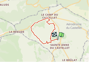
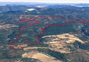
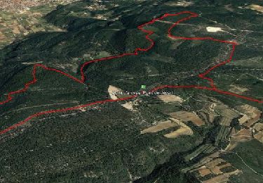
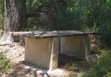
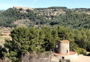
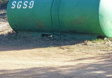
Tocht van 14,9 km beschikbaar op Provence-Alpes-Côte d'Azur, Var, Le Castellet. Deze tocht wordt voorgesteld door michelpaulin.

Beschrijving

Belle balade

Hoogteprofiel

Foto's

Plaatsbepaling

Land:
France
Regio :
Provence-Alpes-Côte d'Azur
Departement/Provincie :
Var
Gemeente :
Le Castellet
Locatie:
Unknown
Vertrek:(Dec)
Vertrek:(UTM)
724289 ; 4790356 (31T) N.

Wandeltochten in de omgeving

Tocht Stappen Le Beausset - Trace_Quatre_Freres - Photo
Stappen
GUIDE
affinetataille

Stappen

Zeer moeilijk
(1)
Le Beausset, Provence-Alpes-Côte d'Azur, Var, France
14,8 km | 19,6 km-effort
4h 26min
Ja
Tocht Stappen Le Castellet - SityTrail - 2361987 - begude - Photo
Stappen
GUIDE
affinetataille

Stappen

Medium
(1)
Le Castellet, Provence-Alpes-Côte d'Azur, Var, France
11,5 km | 15,1 km-effort
4h 0min
Ja
Tocht Stappen Le Beausset - Tête du Cade par abime de Maramouyé - Photo
Stappen
sonneville

Stappen

Heel gemakkelijk
(1)
Le Beausset, Provence-Alpes-Côte d'Azur, Var, France
12,4 km | 16,1 km-effort
3h 36min
Ja
Tocht Noords wandelen La Cadière-d'Azur - 20220329_La Cadière d'Azur - Photo
Noords wandelen
Marcsaintcyr

Noords wandelen

Heel gemakkelijk
(1)
La Cadière-d'Azur, Provence-Alpes-Côte d'Azur, Var, France
6,8 km | 8,6 km-effort
1h 30min
Ja
Tocht Noords wandelen La Cadière-d'Azur - 20220329_La Cadière d'Azur - Photo
Noords wandelen
Marcsaintcyr

Noords wandelen

Heel gemakkelijk
(1)
La Cadière-d'Azur, Provence-Alpes-Côte d'Azur, Var, France
6,8 km | 8,6 km-effort
1h 30min
Ja
Tocht Stappen Cuges-les-Pins - cuges barres de castillon OK coral - Photo
Stappen
michelpaulin

Stappen

Medium
(1)
Cuges-les-Pins, Provence-Alpes-Côte d'Azur, Bouches-du-Rhône, France
10,9 km | 14,9 km-effort
5h 54min
Ja
Tocht Stappen Signes - grotte du mounoi signes - Photo
Stappen
marchev

Stappen

Medium
(1)
Signes, Provence-Alpes-Côte d'Azur, Var, France
17 km | 21 km-effort
4h 45min
Ja
Tocht Stappen La Cadière-d'Azur - la Cadière d'Azur 01-03-2024 - Photo
Stappen
Christiancordin

Stappen

Gemakkelijk
La Cadière-d'Azur, Provence-Alpes-Côte d'Azur, Var, France
6,3 km | 8,3 km-effort
2h 26min
Ja
Tocht Stappen Signes - Vallon des Martyrs Signes - Photo
Stappen
sonneville

Stappen

Moeilijk
Signes, Provence-Alpes-Côte d'Azur, Var, France
14,9 km | 18,3 km-effort
4h 9min
Ja


Sluiten
Mijn abonnementen